SOURCE: AFI

In an intriguing development along India’s northeastern frontier, a People’s Liberation Army (PLA) reconnaissance drone, identified as the WL-10 or WL-2, has reportedly been sighted near Sikkim, operating out of China’s Shigatse airbase in Tibet. This rare spotting, noted on March 25, 2025, has sparked interest among defense observers due to the drone’s elusive nature and its proximity to the sensitive Indo-China border.
Adding to the intrigue, the drone’s Mode-S address—listed as #783132 ’00CA6181’—is believed to be bogus, a tactic previously observed in Chinese unmanned aerial vehicles (UAVs) operating in contested regions like the South China Sea (SCS) and Taiwan theater.
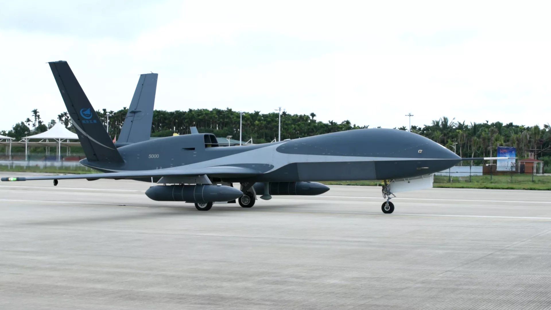
The WL-10, also known as the WL-2 in some contexts, is a high-altitude, long-endurance (HALE) reconnaissance drone developed by China’s aerospace industry. Designed for intelligence, surveillance, and reconnaissance (ISR) missions, it is a lesser-known counterpart to the more publicized WZ-7 Soaring Dragon, which has been deployed at Shigatse since at least 2018. The WL-10/WL-2’s capabilities remain shrouded in secrecy, but its presence near Sikkim—a strategically vital region abutting the Line of Actual Control (LAC)—is a notable event. Posts on X flagged this sighting as “incredibly rare,” highlighting its significance amid ongoing tensions between India and China.
Shigatse, located roughly 150 kilometers from India’s border, is a dual-use civilian-military facility with one of the world’s longest runways at 5,000 meters, tailored for high-altitude operations in Tibet’s thin air. The airbase has long been a hub for PLA Air Force (PLAAF) assets, including J-11 fighters, WZ-7 drones, and KJ-500 airborne early warning aircraft. The appearance of the WL-10/WL-2 adds a new dimension to China’s aerial surveillance network near India, raising questions about its mission and timing.
The same address, ’00CA6181,’ has been linked to a WZ-10 drone spotted near Vietnam’s coast in August 2024, suggesting either a clerical overlap or a deliberate reuse to mask fleet diversity. For India, this raises concerns about the PLA’s ISR activities along the LAC, where accurate identification of aerial assets is critical for border security. The bogus transponder data aligns with China’s broader strategy of maintaining deniability while projecting power in disputed regions.
Sikkim, nestled between Nepal, Bhutan, and Tibet, is a hotspot of Indo-China military friction, with the 2017 Doklam standoff underscoring its geopolitical weight. The region’s proximity to the Siliguri Corridor—India’s narrow link to its northeastern states—makes it a focal point for both nations. China’s deployment of advanced drones like the WL-10/WL-2 near Sikkim could enhance its ability to monitor Indian troop movements, infrastructure development, and border fortifications, especially after recent upgrades to Shigatse’s facilities, including rail lines and underground bunkers.
NOTE: AFI is a proud outsourced content creator partner of IDRW.ORG. All content created by AFI is the sole property of AFI and is protected by copyright. AFI takes copyright infringement seriously and will pursue all legal options available to protect its content.